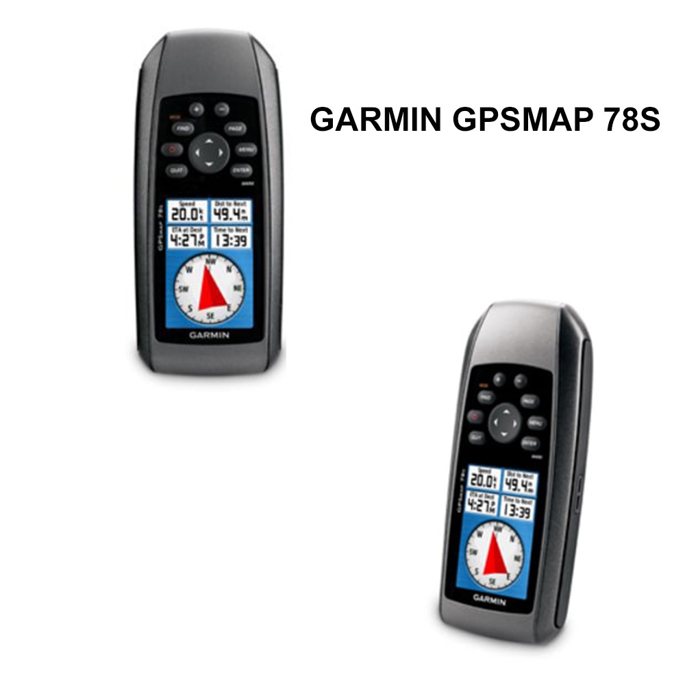


Product Info for Garmin GPSMAP 78s World Wide GPS
Garmin GPSMAP 78s World Wide 010-00864-01 rugged device for watersports enthusiast and boaters alike. If you’re looking to run with the best, then this is it! The Garmin GPSMAP 78-s features crisp color mapping, new molded rubber side grips, high-sensitivity GPS receiver and a microSD card slot for loading more maps. Best of all, like other GPS in the 78-series, it floats!
With the Garmin GPSMAP 78s, you can get your bearings without even moving. The built-in 3-axis tilt-compensated electronic compass shows your heading without holding it level while standing still. This GPS also allows you to share waypoints, tracks, routes and geocaches wirelessly. Meaning, you can share the location of your favorite restaurants or stores. Navigate anywhere with ease using the Garmin GPS MAP 78s. The built-in worldwide basemap will get you where you need to go. The high sensitivity, WAAS-enabled GPS receiver and HotFix satellite prediction will center in on your position quickly and precisely. Even in heavy cover and deep canyons, the Garmin GPSMAP 78s Navigation Device will maintain its GPS location. You can count on this Garmin GPS, regardless if you’re deep in the woods or near tall buildings and trees, to help you find your way. Uploading additional maps is easy with the wide array of detailed marine, topographic and road maps which Garmin has made available on microSD. Simply plug in Garmin BlueChart g2 preloaded cards for a day on the water or Garmin City Navigator NT map data for making your way by road. Don’t worry about the microSD card getting wet. The card slot is located inside of the waterproof battery compartment. This GPS also supports BirdsEye Satellite Imagery (subscription required). This program allows you to download satellite images directly to your device and merge them with your preloaded maps. The Garmin GPS-MAP 78s is also compatible with Custom Maps Software which transforms paper and electronic maps into downloadable maps for your GPS device.
After making your errands or taking a short sail around the marina, you can now store and analyze your activities. Well, that’s simple and easy to do with the Garmin GPSMAP 78s Handheld GPS. Connect the unit to your computer and internet and view a detailed analysis of your activities. You have the ability of sending tracks to your outdoor device by using Garmin Connect, a site which offers an activity table and allows you to view your activities on a map using Google Earth. Ultimately, the Garmin GPS-MAP 78s offers colorful maps, a durable design and buoyant, everything a mariner could ask for or need.
Feature of GARMIN GPSMAP 78s (010-00864-01) :
- Crisp color mapping
- High-sensitivity receiver
- Molded rubber side grips
- microSD card slot for loading additional maps
- Waterproof; floats on water
- Comes with built-in worldwide basemap
- WAAS-enabled GPS receiver and HotFix satellite prediction
- Maintains GPS location in heavy cover and deep canyons
- Easy to add additional maps
- Card slot located inside waterproof battery compartment
- Supports BirdsEye Satellite Imagery (subscription required)
- Compatible with Custom Maps, free software that transforms paper and electronic maps into downloadable maps for device
- Slim and lightweight, the perfect companion for all outdoor pursuits


Reviews
There are no reviews yet.